Irena’s 2022 Washington High-Lite

Irena at the finish
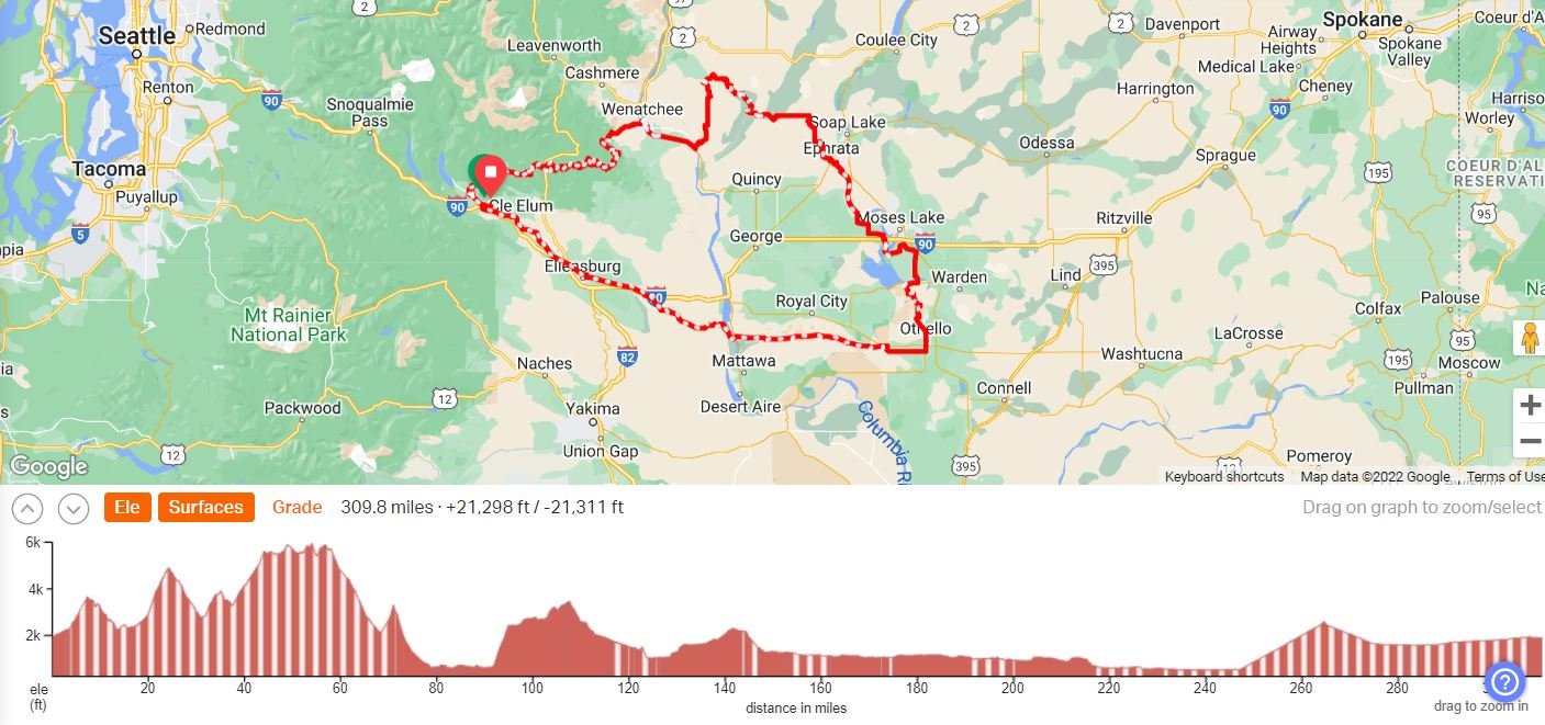
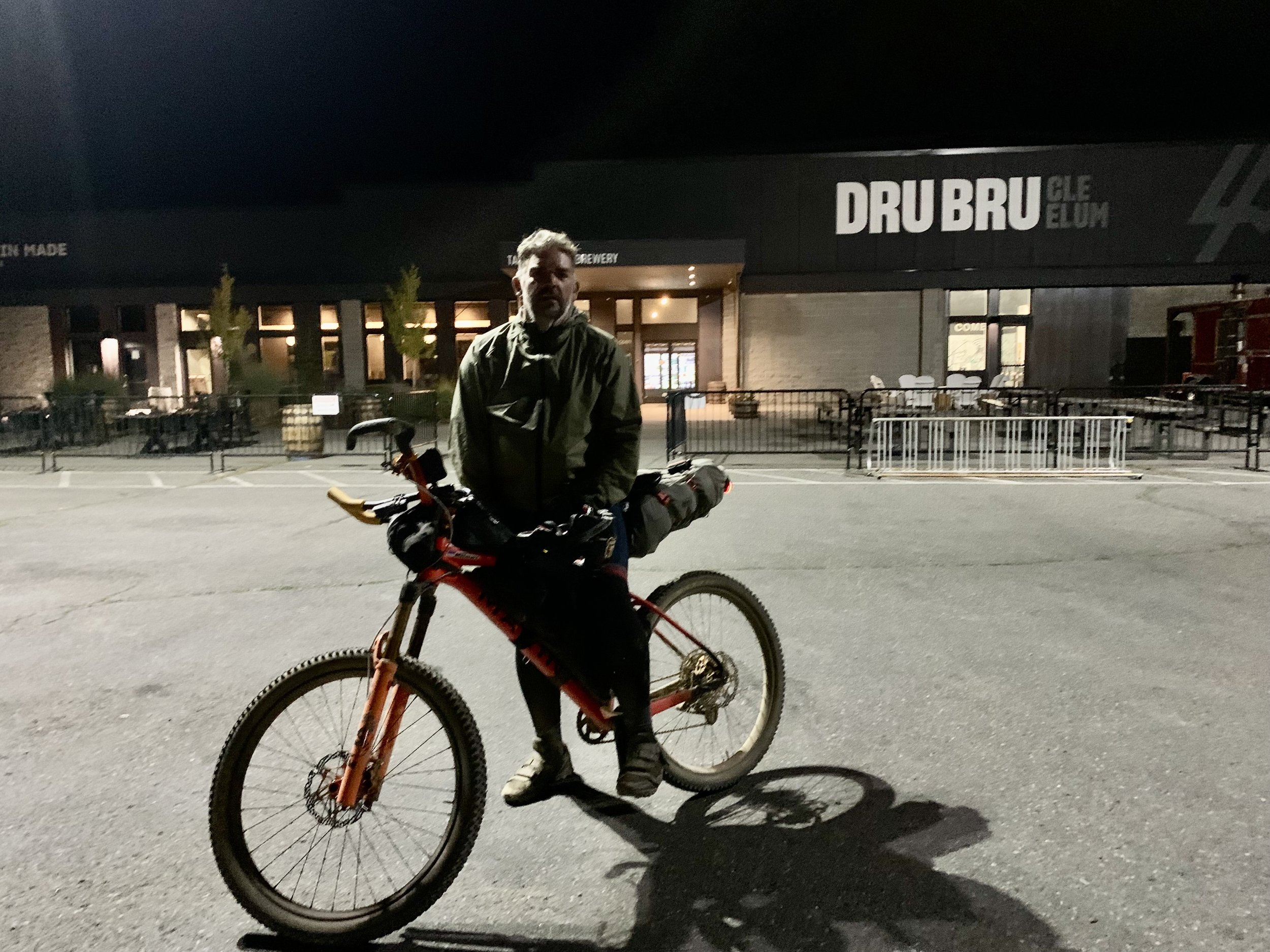
October 1, 2022 Grand Depart from Cle Elum, WA; 309 miles
My story is below while a short event recap is available on bikepacking.com.
Washington High-Lite Loop map and elevation profile:
RACE REPORT
Day 1:

I was the first one at the start for the 7:30 am picture of the Washington High-Lite riders, and there was no one else in sight. I stood alone near the newly-constructed trestle at the beginning of the Coal Miners Trail in Cle Elum. Mike Schreck showed up a few minutes after me and we wondered if we were in the wrong place. Riders started to slowly trickle in. We hovered around, made awkward small talk, and checked out each other’s bikes.
I have completed only a handful of these type of grand departs and usually get the “I don’t belong here/what am I doing here” feelings pulsing through my body but not this morning. I was on home territory. I was familiar with the route and the towns. If anything went really wrong, I was within a few hours of my home and could easily “call a friend” to retrieve me. I have about 1000 miles on this bike setup and it’s been tuned for this race with new tires, chain and brake pads. The weather forecast was looking warm and dry for October, so I packed light but with appropriate safety margins. I felt ready. I felt confident. I belong here.

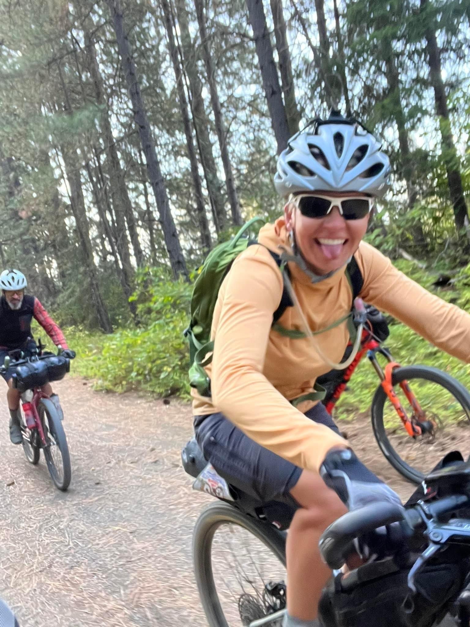
I was delighted to see three other women at the start and made quick conversation before realizing that the riders were already rolling up the Coal Miners Trail towards Roslyn.
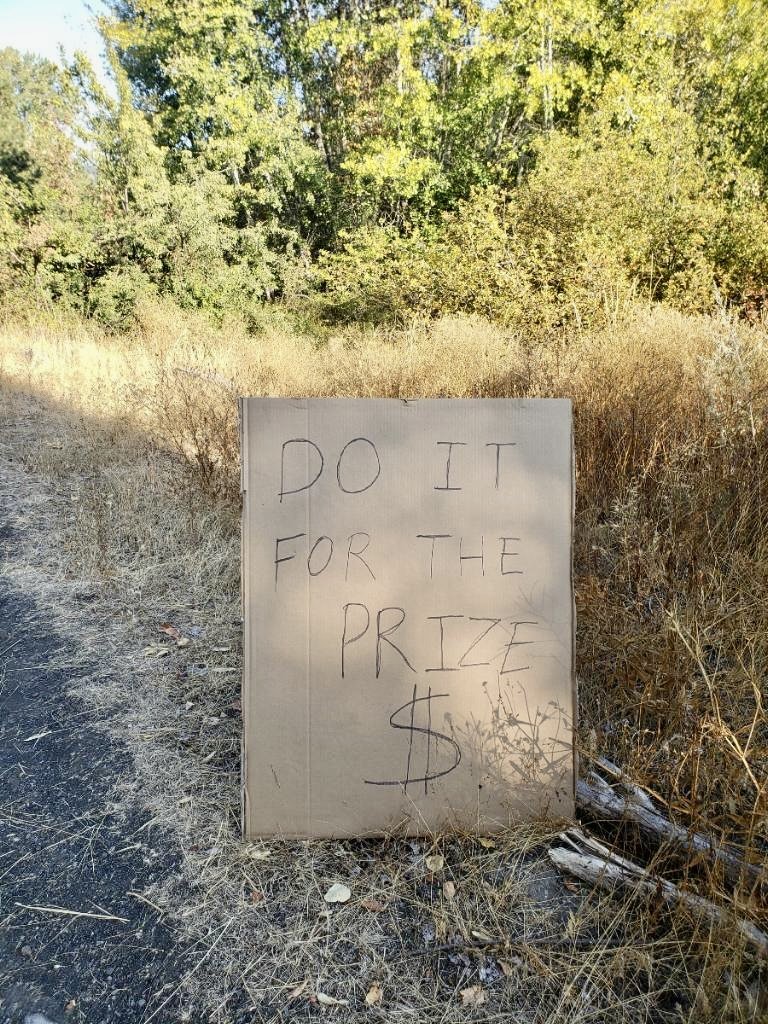
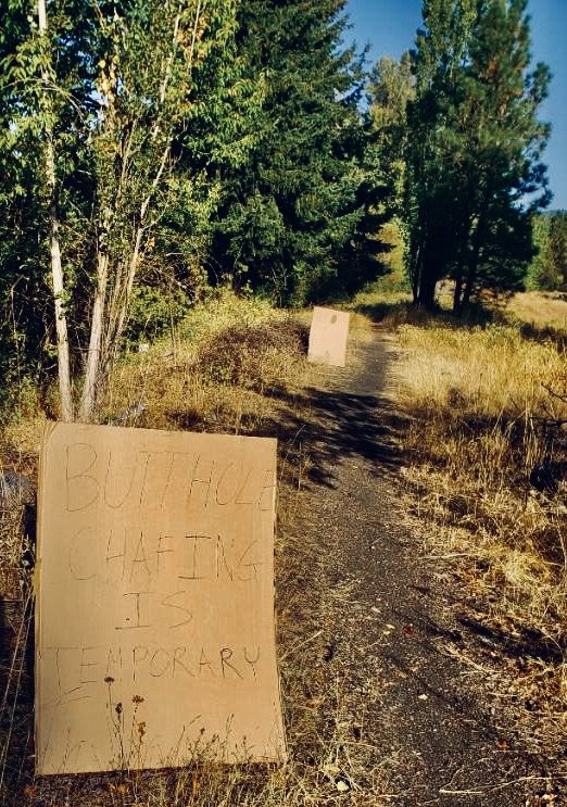
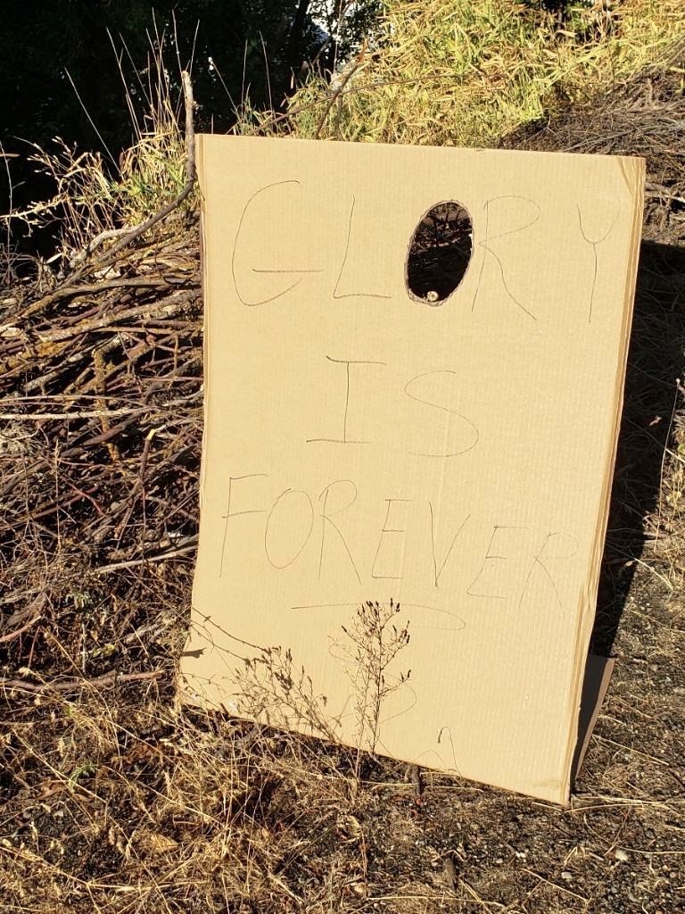
The route followed the trail behind my backyard and Justin and friends provided lots of laughs with his clever signage. Dan, in costume, and Deanna were cheering closer to Roslyn and Glenn, Ride Roslyn bike shop owner, snapped some silly photos when he briefly rode with us.
I didn’t want to get caught up around a bunch of riders on the climb up the ridge on the Ewok trail, so I pedaled a little harder than I would at a start of a race to create some space. Troy and Mike were near me at the bottom but pretty soon I was alone.
I have ridden the 80 miles to Wenatchee at the beginning of August, so I knew what was ahead. Looking at a map and elevation profiles for this section understates the effort that it will take to reach Wenatchee. I was mentally prepared for the slow grind up the steep climbs and beautiful views. I looked forward to the Mineral Springs store, my first milestone, and few riders (Jeff, Thomas, Mike) went through there around the same time that I did. I ate an ice cream, drank a Coke and was through there quickly, rolling out shortly behind Jeff. My goal for the race was to be efficient with my time and make continuous forward progress as much as possible. I am not sure if that was the reason why I didn’t take any pictures on the first day.
Mike was right behind me as we hauled our bikes over a fallen tree, and we briefly biked together but that was the last that I saw of him as I pulled away up the hill. Jeff and I played cat and mouse a couple times somewhere past the Mission peak. A nice Saturday in October brought out a lot of ATV riders and motorcycles driving way too fast on narrow, sketchy, dusty roads. I got off my bike and off the road as much as possible when I saw them approach. A fast descent down to Mission Creek where I rode through the creek, stepped on rocks and balanced on the washed-out edge of the road but still fell over and scraped my knee. The final climb into Wenatchee provided ankle deep moon dust and required a hike up and a walk partway down – this was much worse than in early August. My goal was to reach Wenatchee between 8 and 9 pm and I was delighted when I realized it was 7:30 pm as I cruised into town.
Towns are a time suck. I had planned out which gas stations I was going to visit in Wenatchee, Ephrata, Moses Lake and Othello and I was familiar with their hours of operation. In Wenatchee, I sat in front of a 7-Eleven (on a disgusting concrete sidewalk), ate my sandwich and checked the locations of other riders using Troy’s newly developed tracking website, Bandog. Several people were pulling into Wenatchee in the time that I sat in front of the store but it looked like their dots stopped moving. I stuffed my frame bag with an assortment of candy bars, nuts, cookies and sandwiches. My goal was to continue past Wenatchee and tackle the brutally steep Rock Island grade climb and camp somewhere around the high point before the descent towards the Douglas Creek canyon.
I hated biking the ten miles along the highway leaving Wenatchee in the dark and was happy to get back on dirt and away from cars. I cleaned my chain under one of the picnic shelters along the Columbia River and all the motion-sensor lights illuminated me. This would have been a terrible place to sleep but a great place for a little bike maintenance. I checked the tracker one last time before I figured I’d lose my cell signal and saw that Jason made a quick pass through Wenatchee and was on the move. I was sure that he would continue through the night and pass me while I slept or before.
It was a warm, pleasant night, and I took off my Houdini jacket and leg warmers shortly after I started climbing the Rock Island Grade. I walked and cycled and walked and cycled and admired the night sky. I was scouting a camp spot but felt ok to keep going so I reached the high point, made the right turn and started the descent. Both my helmet and handlebar lights shone bright as I passed a farmhouse and scouted the farmland and sage brush for a camping spot.
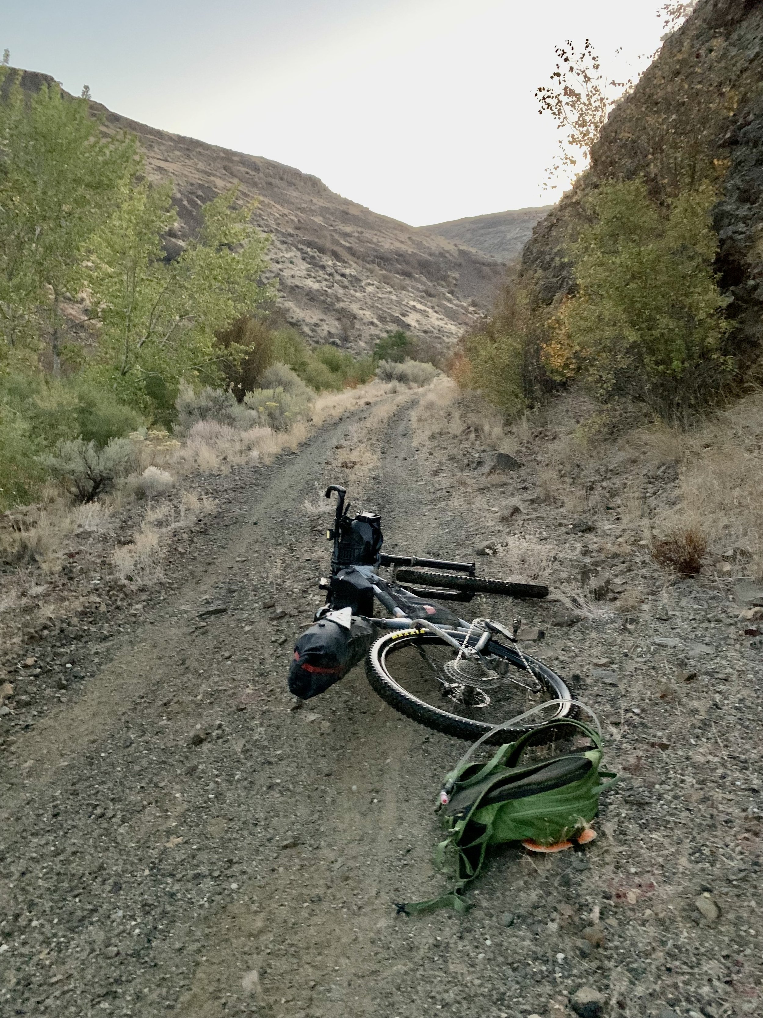
I found a flat spot to sleep among the sage brush, laid the bike down and rolled out my bivy with the sleeping bag and Thermarest already inside. I inflated my Thermarest, took off my shorts and put on my wool long underwear, placed my shoes upside down near my head, took out my contacts and set my alarm. I changed how I organized and packed my gear and was delighted that it took me only 20 minutes from the time that I stopped to being ready to sleep. The stars in the sky were stunning and it was quiet and calm. I gave myself 2 hours to sleep.
On day 1, I covered over 112 miles and 15,000 ft of climbing.

Day 2:
When my alarm went off, I checked the tracker first. Jason slept somewhere up the Rock Island Grade so I was pretty excited to realize that he didn’t pass me during the night. I didn’t see any other dots but knew that the tracking wasn’t working for some riders so I wasn’t sure where everyone was and I couldn’t find the dots of the other women racing.
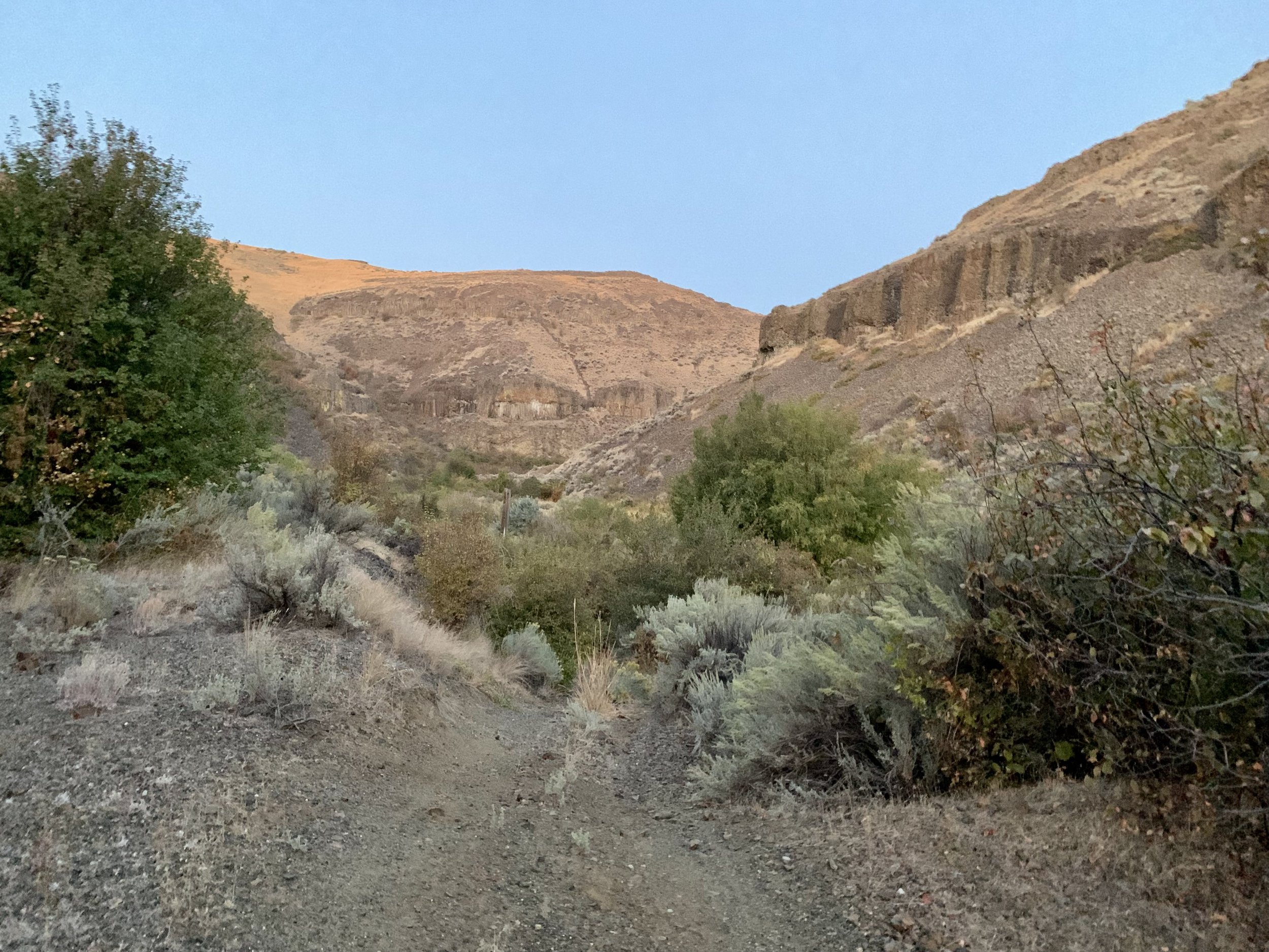
Sometime around 4:30 am, I started my day descending into the Douglas Creek canyon area. I thought it would be cold and kept my down jacket on with the rain jacket overtop but within a few minutes of riding, I took off both and just wore my windbreaker over my sun hoody. Troy warned us that the route through Douglas Creek is different, but I still blew past the turn off. My GPS told me that I was going the wrong way, but I didn’t see anything that looked like a trail. Finally, I backtracked enough to find the start to the overgrown trail. I later learned that Chad was sleeping near the intersection and heard me go by. The first part of the trail was washed out in sections, overgrown with shrubs and had a rocky obstacle course. I was on and off the bike, and took it slow in the dark. I turned on both lights, handlebar and helmet, so that I could get a good look at what was ahead. As the sun came up, I snapped a few photos of the canyon and could see where the early August fire burned but luckily didn’t go all the way through the canyon.
I was surprised that the creek crossings through the canyon had knee deep water. It was slow going through this section. At every creek crossing, I scouted a way around the water, but it never worked out, so I would take my shoes and socks off and walk through, balancing, holding onto my bike. This was a tedious process, but I knew that my beefy shoes would take way too long to dry had I just walked through the water in them. I felt joy when I reached the signage at the end of the canyon and descended into the Palisades area. This felt like another important milestone, but I was already thinking ahead to Ephrata since my goal was to get there by noon. I climbed my way out of the Palisades and rolled across wide open farmland up and over to my next resupply.
Somehow it feels more rewarding to bike into a city on a paved downhill. I did a little pavement dance when I turned onto Sagebrush Flats road a few miles outside of Ephrata. I was aware of the short trail section at the beginning of town but of course turned the wrong way around a church and had to back track again. Subway wasn’t open yet when I biked by at 10:40 am so I went directly into the Conoco gas station across the street. A breakfast sandwich warmed up in the gas station microwave with a side of a long john donut were a “good enough” breakfast. I turned my phone off airplane mode and went looking on the Facebook page for any updates. The Columbia Wildlife refuge was closed and we needed to detour. Troy didn’t yet have a new route so I responded that I will check again when I reach Moses Lake and provided my general plan if I don’t hear from him. I filled up my water, cleaned and lubed my chain, and I was on my way.
It was hot and dry and mostly flat in the stretch to Moses Lake. I was feeling good about my overall progress. The wonderful ladies working the cash register at the Love’s gas station in Moses Lake were kind, helpful and confused by me as they tried to understand how I stayed safe. One of the older ladies was ending her shift and she stopped to chat with me outside as I was eating and drinking my Gatorade. As our conversation ended, she told me that she would pray for me. I thanked her.
There were no updates on the detour and Chad’s dot was closing in with less than 10 miles behind me. I was sure that he would catch me before Othello, but I was confident that I built a big enough gap with the next few riders behind him. I pulled my hood over my helmet and biked into the hot afternoon sun towards Othello. Through the dusty Moses Lake sand dunes, I was curious what the infamous carp crossing would bring. In the spring, during the Cross-Washington race, I saw pictures of waist deep water so I was a bit worried what I was up against.

Luckily the water was low, and I easily crossed the creek. The next part required me to push my bike up a steep, washed out, bank. It’s shenanigans like these that lead me to carry water in a backpack bladder, keeping my bike light enough to carry, push or pull. My feet disappeared in the dirt with each step, and I had to lift and scoot my bike up along with me. I hoisted my bike up over the top edge, climbed up and then emptied the sand from my shoes. I felt relief to have this crossing behind me.
When I reached highway 262, I stopped and checked my phone again. Turning right would take me to the refuge but if I go left then I should intersect Hwy 17. I had a message from Troy with the map of the detour. I could read his text but I couldn’t load the map. So I proceeded and hoped to find a stronger cell signal ahead. Luckily, I did and I was able to load up the new route on my phone and use the voice navigation feature in RWGPS.
Warden was quiet and the indirect route to Othello took me through farmland, along irrigation ditches, squinting into the most beautiful sunset. It was dark when I approached Othello and the McCain factory was lit up with strong odors filling the air. I was careful to bike through town, unsure how visible I was. The gas station was a couple blocks off route. I was fifth in line, impatient, waiting to buy my rootbeer and water. I planned on this being my last resupply stop so I double checked to make sure that I had enough food.
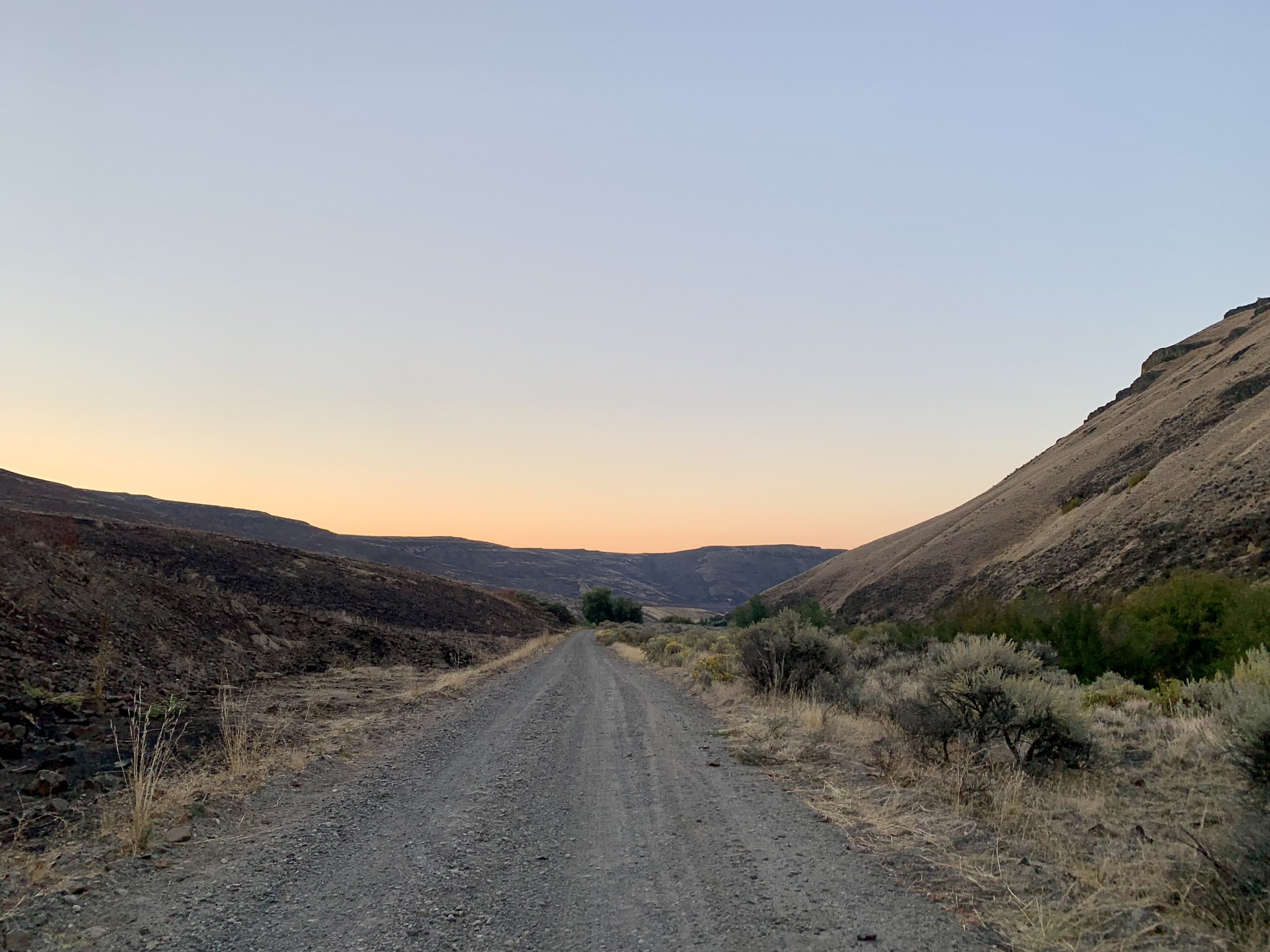
I expected to join the Palouse to Cascade trail just south of town but found myself on roads for another 18 miles before I turned onto the champagne gravel road through the Crab Creek Wildlife area. I imagined that this would be a scenic bike ride in the daylight. Chad finally caught up to me shortly after I pushed my bike up onto the Palouse to Cascade trail. We chatted and briefly pedaled together. It was nice to have company even though it didn’t last long. We discussed pushing through the night to finish in under two days but we both were non-committal. Dogs were out and about on the route even at night. You’d see the beady eyes looking at you, hoping that the dog was tied up as it sprinted towards the road. My strategy with dogs is to yell at them with force. This has worked so far, because earlier in the day, I stopped a black German Shepherd dog in its tracks, with the right front leg lifted, staring at me confused.
As I pedaled into the night, I started to think about my sleep strategy. I knew that the section after the Beverly bridge is exposed but I didn’t want to stay near the town of Beverly. There was some suspicious activity near the trail as I got closer to town. I passed by a house not far from the trail with a group of people outside and bright lights. They redirected a spotlight towards me. I waved, trying to show confidence and look big but I felt uneasy. My knee was starting to bother me so I figured stopping soon was a good idea but I needed to find a spot where I could feel safe. Finally, about 2 miles outside of Beverly, I pushed my bike off the trail onto some high ground and set up my camp in the tall grass. I was confident that I wasn’t visible and quickly turned my lights off. I heard the traffic in the distance and dogs barking all night. Before going to sleep, I saw that Chad was still moving and started to make his way up the long climb from Beverly.
After 141 miles, I was happy to stop and set my alarm to get 1 hour and 40 minutes of sleep. Honestly, I am not sure how I came up with this time.
Day 3:
I didn’t feel too tired, sleepy or bad getting up around 3 am, packing and getting back on my bike. I was pleasantly surprised how quickly I reached the bridge. I had around 65 miles to the finish of the High Lite route. It was 3 am on day 3. I can do this. I stopped on the Beverly Bridge for some chain maintenance and psyched myself up for the 18-mile, railroad-grade climb through the rolling lands of the US Army Yakima Training Center. I was sleepy. I continuously ate peanut M&Ms and sang made-up songs. I stopped a couple of times, rested my head on my handlebars, and closed my eyes. The tracker indicated that Chad was still stopped, and I calculated that might reach him around mile 15.
I was desperate for human conversation, so I got excited when I saw his light which was moving around but he was not on his bike yet. My happiness ended abruptly when I realized that he was in fact cycling away. In a moment of desperation, I cried after him. I was now on the struggle bus. I decided on a 9-min nap in the world’s cleanest pit toilet next to the trail. I sat down on the concrete outside the door, leaned against the wall into the corner, used my helmet to prop my head up and closed my eyes. That seemed to do the trick. I got back on the bike and slogged my way to the summit. I knew that once I made the climb and crossed the I-90 trestle, it was 45 miles to the finish with a few miles of fast downhill at the beginning. I decided not to make any additional re-supply stops as I cycled past Kittitas. I have cycled this stretch of the Palouse to Cascade trail many times and was confident that I could make it home.
The Central Washington campus in Ellensburg was bustling with students heading to class. I was grateful not to have the usual head wind and enjoyed the scenic Yakima river canyon in the morning light. I was delighted to see Deanna with about 10 miles to go. We biked side by side and I made her do most of the talking to help me stay awake. My right knee was hurting and I wanted to be done.
Finally, the right hand turn on the paved road into South Cle Elum meant that I was about two miles from the finish. The last few miles were an annoying mix of pavement and gravel along the railway tracks behind some warehouses before turning into the Dru Bru parking lot.

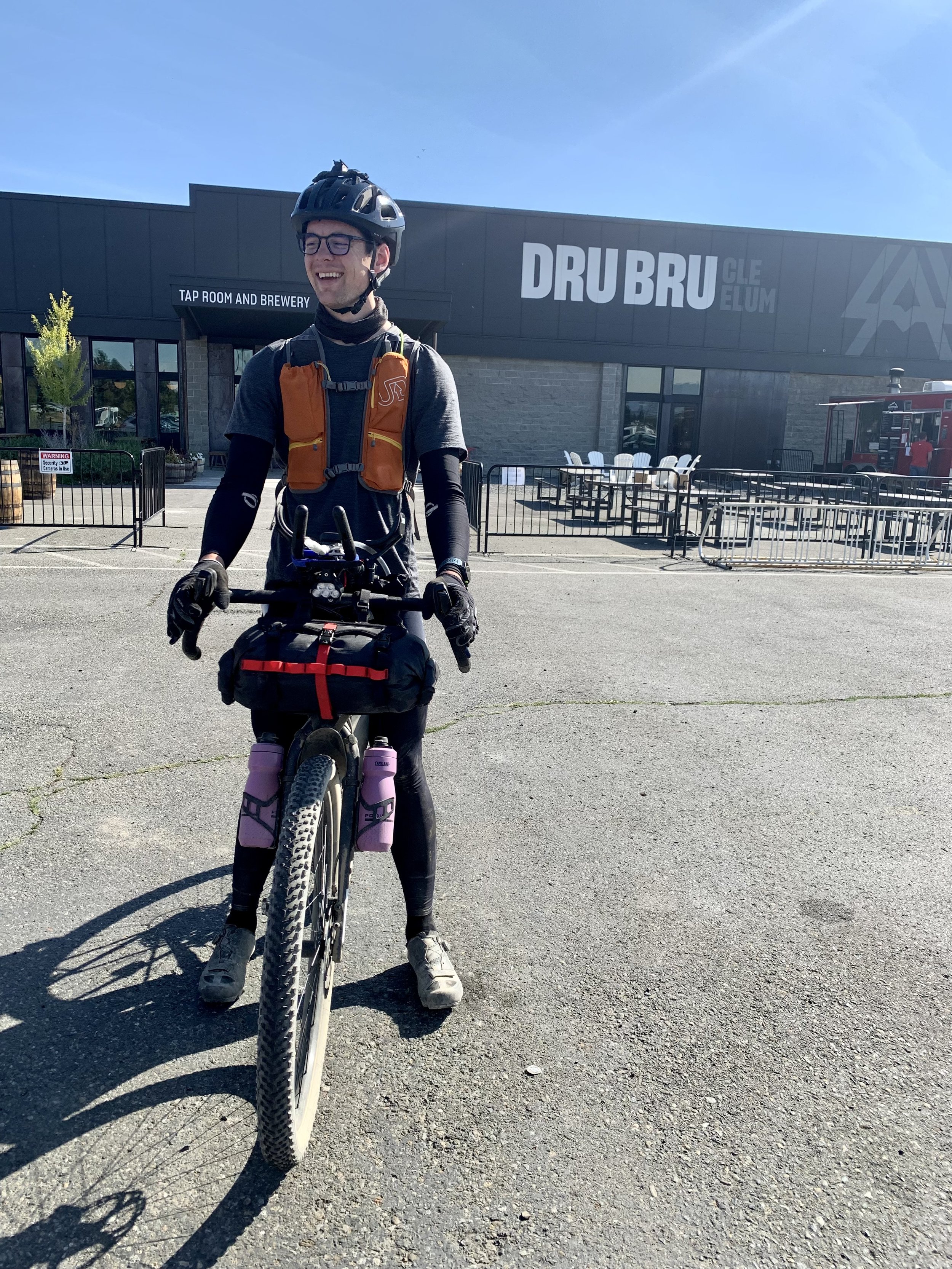
Chad greeted us! We spent the next few hours at Dru Bru swapping stories. At some point in the afternoon, I mustered enough energy to bike the three miles home and Chad and I agreed to track the next few riders and meet them at the finish.
I was back in a couple hours to provide some cowbell for Jeff and then Tomas. Chad and I had an opportunity to celebrate with them before we all went our separate ways. I picked up Jason later in the evening and gave him a ride to his car.
Deanna and I enjoyed meeting finishers at Dru Bru over the next few days and we collected many wonderful stories from their journeys.

I wrapped up 319 miles of the Washington High-Lite route in 2 days 3 hours and 54 minutes which got me sixth place overall and the first woman to finish. Out of 23 starters, 15 finished and 9 scratched. There were 4 women and 19 men.
The finish line is where your GPX track ends, and everyone needs some cowbell.
THANK YOU
Thanks to Troy Hopwood for organizing this event, designing the route with the right amount of shenanigans and kudos on developing a new dot tracking website just for this event. Washington Bikepacking community wouldn’t exist without you.
I am grateful for the support of Ride Roslyn. A summer of riding the Honzo has been a summer without any mechanicals. Thank you for taking good care of my bike.
For once, things went according to plan.